黄颖

职称:
副研究员
研究专长:
滨海湿地生态遥感与大数据
滨海湿地蓝碳过程、机制与模拟
滨海湿地生态系统功能
湿地日光诱导叶绿素荧光遥感与建模
Email:
yhuang@sklec.ecnu.edu.cn
联系地址:
上海市闵行区东川路500号华东师范大学河口海岸大楼A343
学术任职:
中国滨海蓝碳观测研究联盟(CBCC),理事会单位代表
长江技术经济学会长江三角洲保护与发展专业委员会,委员
教育经历:
2010.10—2016.01,荷兰特文特大学 (University of Twente),国际地理信息科学与地球观测学院(ITC),遥感与全球变化方向,博士,导师:Z. (Bob) Su (苏中波)教授、A.Y. Hoekstra教授
2009.09—2010.07,河口海岸学国家重点实验室(华东师范大学),自然地理学,湿地遥感方向,硕博连读,导师:周云轩教授
2007.09—2009.07,河口海岸学国家重点实验室(华东师范大学),自然地理学,湿地遥感方向,硕士学习,导师:周云轩教授
2003.09—2007.07,太原理工大学,矿业工程学院,资源环境专业,工学学士
工作经历:
2024至今,河口海岸全国重点实验室(华东师范大学),副研究员,博士生导师
2020至2024,河口海岸学国家重点实验室(华东师范大学),副研究员,硕士生导师
2016至2019,河口海岸学国家重点实验室(华东师范大学),地学部学科博士后
个人简介:
本人近年来围绕滨海湿地生态系统监测、碳循环机制解析与全球变化响应等关键科学问题,融合野外观测、卫星遥感与人工智能等多源技术,形成了从过程机理认知、尺度扩展方法创新到全球风险评估的系统性研究体系,取得了以下代表性成果:(1)率先揭示新型荧光遥感技术动态监测盐沼光合固碳过程的作用机制与应用潜力;(2)创新提出滨海湿地-大气界面碳通量时空尺度推译新方法,突破碳通量空间外推与尺度转换限制;(3)率先实现滨海湿地横向碳通量的高精度量化,揭示其对碳收支平衡的重要影响;(4)阐明互花米草入侵与治理、芦苇冬季收割等典型人类活动对盐沼碳循环的影响机制;(5)建立自然过程与人类活动耦合影响下全球滨海蓝碳生态系统脆弱性评估体系,识别关键脆弱带并提出管理策略。相关成果丰富了滨海湿地碳循环理论,推动了滨海蓝碳监测与评估方法创新,为全球湿地资源保护、生态系统管理及应对气候变化提供了重要科学支撑。
主要使用的软件、工具或编程语言:IDL+ENVI、Matlab、GEE、Python、Jupyter、ArcGIS等。
每年预招收硕士研究生1~2名(总年津贴2W+),博士研究生1名(总年津贴6W+),欢迎报考!招生专业包括自然地理学、生态学。总年津贴包括国家和学校的奖助学金和导师发放的津贴。除基础津贴外,根据个人对项目的贡献,还将提供额外的奖励科研津贴。
欢迎具有地理信息科学、生态学、自然地理与资源环境、海洋科学相关专业背景的同学推免或报考。读研期间表现优异者可推荐到国内外知名学府继续深造。
指导研究生:
杨**(2020级生态学,院优秀开题)
卢**(2021级自然地理学); 赖**(2021级生态学)
谢**(2022级自然地理学, 优秀学位论文); 陈**(2022级自然地理学, 优秀学位论文); 葛**(2022级生态学,校优秀学位论文)
张**(2023级生态学,院优秀开题); 吕**(2023级自然地理学)
江**(2024级自然地理学,院优秀开题); 马**(2024级自然地理学)
夏** (2025级自然地理学); 吴**(2025级生态学)
张** (2026级自然地理学,直博生)
-----------------------------------------------------------------------------------------
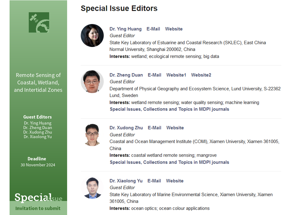
Remote Sensing期刊“Remote Sensing of Coastal, Wetland, and Intertidal Zones”专刊征稿启事
本人作为客座主编,与瑞典隆德大学、厦门大学的几位同仁,共同在Remote Sensing期刊(中科院二区)“Ocean Remote Sensing”栏目下组织了专刊“Remote Sensing of Coastal, Wetland, and Intertidal Zones”,欢迎投稿!
目前该专刊已经过同行评议发表了10篇论文,即将有电子书出版号。专刊第二期即将开放,欢迎投稿!
科研项目:
- 国家自然科学基金委员会,面上项目,42471396,滨海盐沼日光诱导叶绿素荧光与生产力对环境因素的协同响应机理与模型研究,2025-01至2028-12,主持;
- 国家重点研发计划“政府间国际科技创新合作”重点专项,中国-欧盟科技创新合作项目:近海蓝碳生态系统的碳汇潜力与多功能协同增汇途径,2023YFE0113100,2023-12至2027-11,子课题负责人:长江口盐沼湿地碳汇监测、碳收支清单,以及和卫星遥感结合的跨尺度数据融合;
- 事业单位项目,上海市野生动植物和自然保护地研究中心,上海市湿地生态综合监测数据耦合,2025-10至今,主持;
- 事业单位项目,上海市环境科学研究院,崇明西沙湿地碳通量采集与分析,2025-6至今,主持;
- 事业单位项目,上海市环境科学研究院,横沙地区生态格局模型构建及测试,2024-11至2026-06,主持;
- 国家重点研发计划“战略性科技创新合作”重点专项:气候变化和人类活动对海上丝路沿线国家滨海蓝碳生态系统的耦合影响机制与合作研究,2022YFE0209300,2022-11至2025-10,子课题负责人:海上丝路沿线国家滨海蓝碳生态系统脆弱性评估与关键脆弱带识别;
- 上海市科学技术委员会,“科技创新行动计划” 自然科学基金面上项目,22ZR1419400,基于多源观测的高时空分辨率滨海盐沼湿地生产力遥感估算研究,2022-04至2025-03,主持;
- 事业单位项目,上海市野生动植物和自然保护地研究中心,上海市湿地生态综合监测数据耦合,2024-10至2024-12,主持;
- 事业单位项目,上海市九段沙湿地自然保护区管理事务中心,上海九段沙湿地植被-土壤-水体蓝碳监测技术研究,2023-05至2023-12,主持;
- 国家自然科学基金“面向国家碳中和的重大基础科学问题与对策”专项项目:陆海统筹下的中国海岸带生态系统保护修复与固碳增汇协同增效,42141016,2022-01至2025-12,298万,参与;
-
国家自然科学基金委员会,青年科学基金项目,41801253,滨海盐沼植被日光诱导叶绿素荧光与总初级生产力的关联机制,2019-01至2021-12,28.8万,主持;
- 中国博士后科学基金会,面上项目,2016M601540,潮汐淹水对九段沙湿地热、水、碳交换的影响与机理研究,2017-01至2018-12,5万,主持;
- 河口海岸学国家重点实验室(华东师范大学)自主课题,2016RCDW04,基于过程模型的长江口盐沼湿地水、热、碳通量模拟研究,2016-07至2019-06,15万,主持;
-
国家重点研发计划“中荷(兰)政府间国际科技创新合作”重点专项:应对转型中的河口三角洲,何青研究员主持,2016YFE0133700,2018-01至2022-12,708万,参与;
-
华东师范大学“幸福之花”生态+先导研究基金项目:长江河口及滨海湿地固碳功能、机制及其应用,唐剑武教授主持,2020-07至2022-12, 200万,项目骨干;
-
上海市科学技术委员会,社会发展科技攻关项目,长江河口滩涂生态脆弱区监测与安全预警关键技术,何青研究员主持,20dz1204701,2020-09至2022-08,参与;
-
国家重点研发计划:长三角典型河口湿地生态恢复与产业化技术,李秀珍研究员主持,2017YFC0506000,2017-07至2021-06,1398万,项目骨干;
课程教学:
2024、2025学年研究生专业课《海岸带遥感技术与应用》主讲,36课时
2027年及以后研究生专业课《海岸带遥感技术与应用》主讲,18课时
2021—2024年“河口海岸研究进展”教授讲座:海岸带蓝碳的定量研究方法与前沿进展
学术论文:
- Chen, J., Zhang, Y., Jiang, H., & Huang, Y.* (2026). Global Vulnerability of Coastal Blue Carbon Ecosystems to Climate and Anthropogenic Impacts: A Spatiotemporal Perspective. Journal of Cleaner Production, 573, 148929. http://doi.org/10.1016/j.jclepro.2026.148929(自然指数(Nature Index)期刊,1区 TOP,IF:10.7)
- Xie, Y., Zhang, X., Chen, X., Ni, X., Lv, J., Tang, J., & Huang, Y.* (2026). High-frequency dynamics of dissolved carbon fluxes from machine learning and their contribution to carbon budgets in tidal marsh wetlands in the Yangtze River Estuary, China. Water Research, 125390. http://doi.org/10.1016/j.watres.2026.125390(自然指数(Nature Index)期刊,1区 TOP,IF:12.8)
- Chen, J., Zhang, Y., Jiang, H., & Huang, Y.* (2026). Vulnerability assessment of coastal blue carbon ecosystems along the Maritime Silk Road: Future projections and key drivers. Acta Oceanologica Sinica. Accepted. (2区)
- Huang, Y.*, Wang, J., Wu, P., Duan, Z., Li, X., & Tang, J. (2025). Impacts of Spartina alterniflora invasion on coastal carbon cycling within a native Phragmites australis-dominated wetland. Agricultural and Forest Meteorology, 363, 110405. https://doi.org/10.1016/j.agrformet.2025.110405(1区 TOP,IF:5.6)
- Lai, J., & Huang, Y.* (2024). Potential of solar-induced chlorophyll fluorescence for monitoring gross primary productivity and evapotranspiration in tidally-influenced coastal salt marshes. Remote Sensing, 16(24): 4636. https://doi.org/10.3390/rs16244636(2区,IF:4.2)
- Huang, Y.*, Jia, Q., Wang, J., Lee, S-C., Li, X., Li, X., & Tang, J. (2024). Winter harvesting reduces methane emissions and enhances blue carbon potential in coastal Phragmites wetlands. Science of the Total Environment, 938, 173380. https://doi.org/10.1016/j.scitotenv.2024.173380(1区 TOP,IF:8.2)
- Lu, Y., Huang, Y.*, Jia, Q., & Xie, Y. (2024). Capturing the net ecosystem CO2 exchange dynamics of tidal wetlands with high spatiotemporal resolution by integrating process-based and machine learning estimations. Agricultural and Forest Meteorology, 352, 110045. https://doi.org/10.1016/j.agrformet.2024.110045(1区 TOP,IF:5.6)
- Yang, Z., Huang, Y.*, Duan, Z., & Tang, J. (2023). Capturing the spatiotemporal variations in the gross primary productivity in coastal wetlands by integrating eddy covariance, Landsat, and MODIS satellite data: A case study in the Yangtze Estuary, China. Ecological Indicators, 149, 110154. https://doi.org/10.1016/j.ecolind.2023.110154(2区 TOP,IF:6.263)
- Huang, Y., Zhou, C., Du, M., Wu, P., Yuan, L., & Tang, J.* (2022). Tidal influence on the relationship between solar-induced chlorophyll fluorescence and canopy photosynthesis in a coastal salt marsh. Remote Sensing of Environment, 270, 112865. https://doi.org/10.1016/j.rse.2021.112865(遥感领域权威期刊,1区 TOP,IF:13.50)
- Meng, L., Huang, Y.*, Zhu, N., Chen, Z., & Li, X. (2021). Mapping properties of vegetation in a tidal salt marsh from multi-spectral satellite imagery using the SCOPE model. International Journal of Remote Sensing, 42, 422-444.
- Huang, Y., Chen, Z., Tian, B., Zhou, C., Wang, J., Ge, Z., & Tang, J.* (2020). Tidal effects on ecosystem CO2 exchange in a Phragmites salt marsh of an intertidal shoal. Agricultural and Forest Meteorology, 292-293,108108. (1区 TOP,IF:5.734)
- Huang, Y., Guo, H., Chen, X., Chen, Z., van der Tol, C., Zhou, Y., & Tang, J.* (2019). Meteorological controls on evapotranspiration over a coastal salt marsh ecosystem under tidal influence. Agricultural and Forest Meteorology, 279, 107755. (1区 TOP,IF:4.189)
- Huang, Y., Zhang, T., Wu, W., Zhou, Y., & Tian, B.* (2017). Rapid risk assessment of wetland degradation and loss in low-lying coastal zone of Shanghai, China. Human and Ecological Risk Assessment: An International Journal, 23(1), 82-97.
- Huang, Y.*, Salama, M. S., Su, Z., Velde, R. v. d., Zheng, D., Krol, M. S., et al. (2016). Effects of Roughness Length Parameterizations on Regional-Scale Land Surface Modeling of Alpine Grasslands in the Yangtze River Basin. Journal of Hydrometeorology, 17(4), 1069-1085.(2区)
- Huang, Y.*, Salama, M. S., Krol, M. S., Su, Z., Hoekstra, A. Y., Zeng, Y., & Zhou, Y. (2015). Estimation of human-induced changes in terrestrial water storage through integration of GRACE satellite detection and hydrological modeling: A case study of the Yangtze River basin. Water Resources Research, 51(10), 8494-8516.(1区 TOP)[该论文被世界气候研究计划(WCRP)/全球能量和水循环试验(GEWEX)国际重大项目委员会选定为研究亮点(Research Highlight): https://www.gewex.org/research-highlights-index/]
- Huang, Y.*, Salama, M. S., Krol, M. S., van der Velde, R., Hoekstra, A. Y., Zhou, Y., & Su, Z. (2013). Analysis of long-term terrestrial water storage variations in the Yangtze River basin. Hydrol. Earth Syst. Sci., 17(5), 1985-2000.(1区 TOP)
- Huang, Y., Zhou, Y.*, Li, X., Kuang, R., & Zheng, Z. (2009). Two Strategies for Remote Sensing Classification Accuracy Improvement of Salt Marsh Vegetation: A Case Study in Chongming Dongtan. Paper presented at the 2009 2nd International Congress on Image and Signal Processing.
-
陈梓涵, 黄颖*, 唐剑武, 田波, 沈芳, 吴鹏飞, 袁庆, 周成, 王江涛 (2021). 长江口九段沙盐沼湿地生态系统通量贡献区分析. 华东师范大学学报(自然科学版), 2021(2): 42-53.
-
黄颖, 周云轩*, 吴稳, 况润元, & 李行 (2009). 基于决策树模型的上海城市湿地遥感提取与分类. 吉林大学学报(地球科学版), 39(6), 1156-1162.
- Zhang, L., Li, L., Yang, H., Tang, W., Chen, J., Zhou, H., Huang, Y., Chen, X., Li, X., Luo, M., Huang, X., Wang, F., & Ge, Z. (2026). Tidal irrigation-based rice cultivation enhances coastal blue carbon and decreases GHG emissions in brackish mudflats. Agricultural and Forest Meteorology, 378, 111010.
- Liu, S., Liu, Y., Zhang, X., Tian, B., Zhang, W., Huang, Y., Xie, W., Ke, T., Liu, K., Tao, P., Yao, Q., & Tan, K. (2025). Integrating drone multispectral and LiDAR data with machine learning: toward species-level biomass estimation in heterogeneous salt marsh vegetation. Geo-spatial Information Science, 1-19.
- Ge, M., Ren, L., Yang, D., Li, X., Huang, Y., Tang, J., Brix, H. (2025). Invasion of Spartina species enhance blue carbon functions by increasing CO2 uptake and reducing methane emissions in Chinese and Danish coastal wetlands. Journal of Cleaner Production, 508, 145596.
- Zhu, K.-H., Ge, Z.-M., Huang, Y., Zhao, L.-H., Li, Z.-F., Zhao, W., Chen, H.-Y., Zhang, D., Cheng, H.-F., Zhang, W., & Xin, P. (2025). Biogeomorphology and carbon sequestration in a coastal shoal invaded by Spartina alterniflora in the Yangtze Estuary: 22-year simulation for management implication. Ecological Engineering, 220, 107756.
- Xu, Z., Li, X., Tian, P., Huang, Y., Zhu, Q., Zou, H., Huang, Y., Zhang, Z., Zhang, S., Chen, M., & Chen, Y. (2024). Global Warming Potentials of CO2 Uptake, CH4 Emissions, and Albedo Changes in a Restored Mangrove Ecosystem. Journal of Geophysical Research: Biogeosciences, 129, e2023JG007924.
- Zhang, X., Cao, F., Huang, Y. and Tang, J.* (2022). Variability of dissolved organic matter in two coastal wetlands along the Changjiang River Estuary: Responses to tidal cycles, seasons, and degradation processes. Science of The Total Environment, 807, 150993.
- Zhang, Y., Zhang, Q., Liu, L., Zhang, Y., Wang, S., Ju, W., Zhou, G., Zhou, L., Tang, J., Zhu, X., Wang, F., Huang, Y., Zhang, Z., Qiu, B., Zhang, X., Wang, S., Huang, C., Tang, X., & Zhang, J. (2021). ChinaSpec: A Network for Long-Term Ground-Based Measurements of Solar-Induced Fluorescence in China. Journal of Geophysical Research: Biogeosciences, 126, e2020JG006042.
- Hu, Y., Tian, B.*, Yuan, L., Li, X., Huang, Y., Shi, R., Jiang, X., Wang, l., & Sun, C. (2021). Mapping coastal salt marshes in China using time series of Sentinel-1 SAR. ISPRS Journal of Photogrammetry and Remote Sensing, 173, 122-134.
- Corbari, C., Huber, C., Yesou, H., Huang, Y., Su, Z., & Mancini, M. (2019). Multi-Satellite Data of Land Surface Temperature, Lakes Area, and Water Level for Hydrological Model Calibration and Validation in the Yangtze River Basin. Water, 11(12), 2621.
- Wu, W., Yang, Z., Tian, B., Huang, Y., Zhou, Y., & Zhang, T. (2018). Impacts of coastal reclamation on wetlands: Loss, resilience, and sustainable management. Estuarine, Coastal and Shelf Science, 210, 153-161.
- 周云轩, 田波, 黄颖, 吴文挺, 戚纤云, 舒敏彦, 胥为, 葛芳, 魏伟, 黄盖先, 张婷 (2016). 我国海岸带湿地生态系统退化成因及其对策, 中国科学院院刊, 31(10): 1157-1166.
-
周成, 黄颖, 杨华蕾, 杜明卉, 张颖, 唐剑武. 浙南人工红树林秋茄叶片光合作用与荧光特性动态研究[J]. 华东师范大学学报(自然科学版), 2022, 2022(3): 90-100.
学术专著:
Huang, Y. Effects of Climate Variability and Human Activity on Terrestrial Water Storage Changes at Basin Scale: A Case Study of the Yangtze River Basin, Gildeprint Drukkerijen, Enschede, the Netherlands, 2015/12.